Categories
Uncategorized

Understanding the Root Causes of Natural Disasters

Image courtesy of schmid91/Flickr. (CC BY-NC 2.0)

This article was originally published on The Conversation on 27 June 2017.

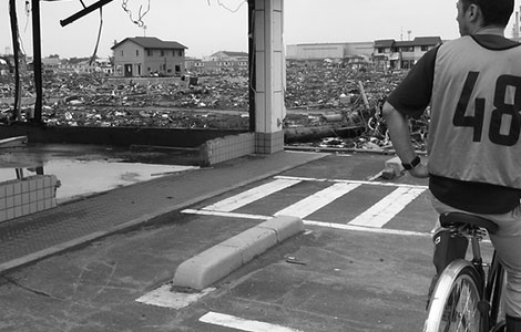
Every year disasters take lives, cause significant damage, inhibit development and contribute to conflict and forced migration. Unfortunately, the trend is an upward one.

In May 2017, policy-makers and disaster management experts from over 180 countries gathered in Cancun, Mexico, to discuss ways to counter this trend.

In the middle of the Cancun summit, news arrived that large parts of Sri Lanka were devastated by floods and landslides, killing at least 150 and displacing almost half a million people.

Don’t Send Your Messages into a Media Black Hole: Communicating about Risk in the Information Age

Danger-sign in the water. Image: Matthew/Flickr

Whether a natural hazard turns into a disaster largely depends on the level of human preparedness. The recent, devastating earthquake in Nepal illustrates this point, where a lack of prevention and mitigation measures pre-disaster contributed to high disaster vulnerability, with terrible consequences for the local population. Communicating to the public about the risks of natural hazards represents a major function of disaster preparedness and resilience. Yet, many efforts to step up communication with the public about risks end in a “media black hole” because they are not properly tailored towards their target groups.

Categories
Humanitarian Issues

New Collaborations for Better Maps in Crisis

OpenStreetMap - Project Haiti 4
Visualisation in OpenStreetMap after the earthquake in Haiti. Photo: ItoWorld/flickr.

Accurate and timely maps are a vital resource in contemporary disaster and crisis management. Maps are essential for identifying vulnerabilities, monitoring the effects of disasters and organizing countermeasures. Traditionally, the mapping of crises was the exclusive domain of experts, including cartographers and crisis management professionals. But with the growing democratization of information and communications technology, this monopoly is disappearing.

Recent disasters have witnessed a new generation of online maps, created by civil society actors and relying on volunteers to collect, organize, verify, visualize and share geo-refer­enced information. Prominent examples include the crowdsourced maps created in the aftermath of the Haitian earthquake in 2010 and during Hurricane Sandy in 2012. Although these mapping projects differed in many respects, they had a common aim – to aggregate geo-referenced information from a large number of sources in order to make that information useful for emergency man­agers as well as those affected by the crisis.