In his 2009 book Aesthetics and World Politics, Roland Blieker made some controversial observations. Traditional forms of IR theory, he argued, exhibit “a masculine [aesthetic] preoccupation with big and heroic events: wars, revolutions, diplomatic summits and other state actions.” This, he claimed, was “supplemented with the scientific heritage of the Enlightenment…[with] the desire to systematize, to search for rational foundations and certainty in a world of turmoil and constant flux.” As one form of representation among many, then, IR theory by definition has aesthetic commitments, but — preoccupied with the ‘scientific’ imperative of representing as ‘mimetically’ (and absently) as possible – it has usually been blind to them.
What then, we should ask, are these hidden aesthetic commitments? And what have been the consequences of hiding them? One way of getting at this is by considering the dominant spatial representations of the world—i.e., the world maps — with which traditional IR theory corresponds. A world map is a way of conceptualizing the human condition as a whole. Maps of the world may be especially relevant to the study of international relations because (as Chris Brown has written) the study of international relations seeks “to build theory on the broadest canvas available” – an orientation that is perhaps its distinctive feature.
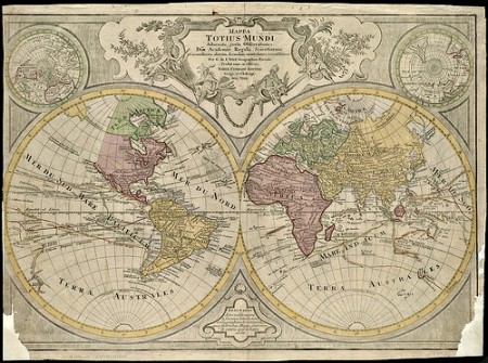
Today’s world maps are romantic; they suggest that what matters are the big and heroic: mountains, oceans, deserts, cities and national borders. And, in faithful positivist fashion, they seek to represent as ‘mimetically’ as possible, specifying magnitudes for mountains and cities and proportionally representing their relative positions. Some of the nicer globes even try to make the mountains the right height. A cursory survey of surviving medieval mappa mundi makes for instructive comparison. Some such maps already focus on the big and heroic, but a key difference is the treatment of space: not exactly absolute and homogeneous when ships, Krakens and the like are the size of Great Britain; and imaginary, undiscovered, or theological places exist alongside real, known, sublunary ones. The influence of the pictures of the world furnished by our globes and global positioning satellites on the pictures of the world furnished by IR theory is perhaps too obvious — yet remains poorly understood.
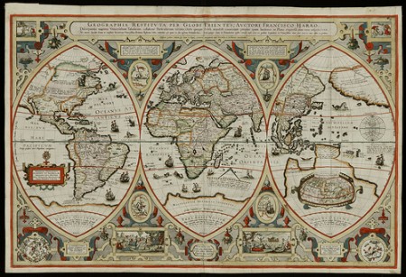

This is why Jordan Branch’s article, “Mapping the Sovereign State: Technology, Authority and Systemic Change,” in the January 2011 issue of International Organization is so refreshing. Branch argues that “mapping technologies in early modern Europe changed how actors thought about political space, organization, and authority, thus shaping the creation of sovereign states and international relations.” Through “the homogenization of territorial authority, the linearization of political boundaries, and the elimination of [previously abundant] non-territorial forms of organization,” maps inspired by the first translation of Ptolemy’s Geographica into Latin, in 1406, may have played a pivotal constitutive role in the genesis of the modern state and the ‘Westphalian’ system. In particular, it was the rediscovery of this work which re-introduced into the Western cartographic imagination the now- familiar coordinate grid of latitude and longitude and, with it, the idea of the world “as a geometrically divisible surface.”
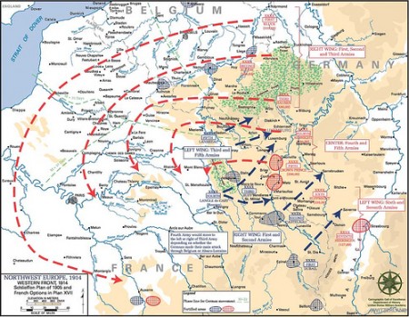
The virtues of maps based on mimetic verisimilitude are as obvious for the technological conquest of nature as for military conquests of other countries. But as Gerard Toal writes: “Maps give us worlds and attempt to render them stable and meaningful. They promise location and knowledge, control and direction. While Western spatial practices are hegemonic there is never an ‘end of geography’, no agreed and singular modern world political map. 9/11 revealed that ‘paradise’ is still on the map for some. That the West in response deployed its panoptic mapping empire over Afghanistan to fight ‘evil’ and guide bombs onto those with coordinates beyond the ‘civilized world’, is evidence that it too has theological ghosts inside its twenty first century mapping mega-machine.”
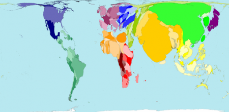
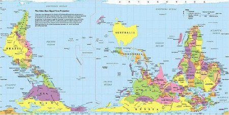
A problem for critical theorists and post-positivists in IR may be that there are no credible post-positivist pictures of the world to rival the masterpieces of technological reason produced by orbiting satellites and global positioning systems. Critics alike agree that the homogeneity of time in neo-realism is at the very least problematic, but the homogeneity of space, which must be so intimately related, remains comparatively unquestioned. As far as alternatives go, we laugh at even the simplest of re-orientations:
And, finally, consider the one-paragraph short story from the Argentine writer Jorge Luis Borges, “On Exactitude in Science,” a meditation on representation, science and time, and which inspired this Special Feature:
“… In that Empire, the Art of Cartography attained such Perfection that the map of a single Province occupied the entirety of a City, and the map of the Empire, the entirety of a Province. In time, those Unconscionable Maps no longer satisfied, and the Cartographers Guilds struck a Map of the Empire whose size was that of the Empire, and which coincided point for point with it. The following Generations, who were not so fond of the Study of Cartography as their Forebears had been, saw that that vast Map was Useless, and not without some Pitilessness was it, that they delivered it up to the Inclemencies of Sun and Winters. In the Deserts of the West, still today, there are Tattered Ruins of that Map, inhabited by Animals and Beggars; in all the Land there is no other Relic of the Disciplines of Geography.”

