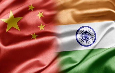
China and India Pull Back on Doklam, Choosing to Fight Another Day

Image courtesy of Times ASi/Flickr. (CC BY 2.0)

This article was originally published by YaleGlobal Online on 14 September 2017.

India deftly used the BRICS summit to end the standoff with China in Bhutan, but challenges remain for bilateral relations

One week can be a long time in inter-state relations. In a week’s time, India and China had kissed and made up after their armies stood eyeball to eyeball at the Doklam Plateau for more than two months. The trouble at the India-Bhutan-China tri-junction started June 16, when Indian soldiers detected construction activity on what is considered disputed territory on the Doklam Plateau. Chinese workers seemed to be building a road that would have allowed China to project power further into the territory claimed by Bhutan, thereby giving Beijing an ability to cut India’s northeast from the mainland.

India’s response was immediate. The government sent troops into Bhutan to halt the roadbuilding, demanding restoration of status quo ante. As the Indian external affairs minister explained in the Indian Parliament: “Our [Indian] concerns emanate from Chinese action on the ground which have implications for the determination of the tri-junction boundary point between India, China and Bhutan and the alignment of India-China boundary in the Sikkim sector.” Sushma Swaraj added that “dialogue is the only way out of the Doklam standoff…and this should be seen in the context of the entire bilateral relationship.”

When Downsizing is a Good Thing for a State

Courtesy Paul B/Flickr

This article was originally published by World Affairs on 13 June 2016.

The following is and interview with Ian Lustick, a Professor of Political Science at the University of Pennsylvania.

MOTYL: Professor Lustick, let’s begin the conversation with your provocative theory of “right-sizing” states. What’s the gist?

LUSTICK: The basic point is pretty obvious. If a person is too thin, gaining weight is a good thing, but not if the weight gain is all in the stomach. To take a more extreme example: If a person is overweight, losing pounds is a good thing, but not if it is achieved by decapitation or sawing off one’s right arm. “Right-sizing” a state is the idea that—although it is dangerous and usually wrong to change a country’s borders when those borders have been settled and have taken on a sense of stability and naturalness—there are circumstances when it can be entirely appropriate to alter the size and shape of a state for the state’s own good and for the welfare of the nation, people, or population that identifies with it.

MOTYL: If the theory makes so much sense—and I agree that it does—why isn’t it practiced more often? What are the main obstacles to right-sizing?

LUSTICK: States commonly seek to get bigger, but more often than not they “wrong-size” themselves by doing so. Except for perhaps a temporary boost to the popularity of the leadership that promises that expansion will yield a bigger pie to divide among their followers, the costs of maintaining rule over far-flung territories and exploited and unhappy indigenous peoples usually vastly outweighs the benefits that can be sustained over a long period of time. That means, however, that many states are bigger than they “should be,” raising the question you have asked: why don’t more states shrink strategically? The reason is that getting smaller is almost always perceived as shrinking the size of the available pie and diminishing the prestige of those who identify with the state. So it is always more difficult to contract rather than expand, even if, strategically, it is likely to be very advantageous to do so. As you can imagine, it is far easier to label a leader who favors withdrawing from a territory a coward or a traitor to the national (or imperial) cause, than it is to challenge the patriotism of a leader embarking on a “glorious” campaign of expansion—one that would typically be characterized as being demanded by the historical (or divine) rights of the nation or its security requirements.

Categories
Regional Stability

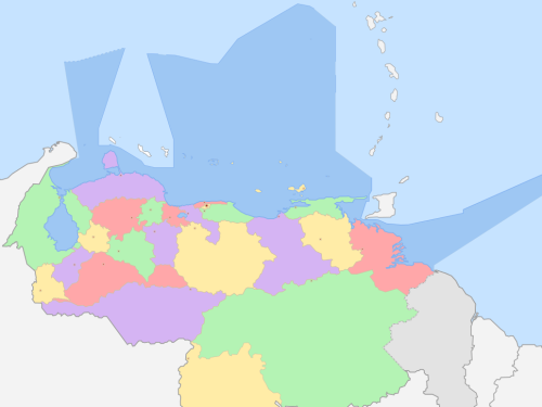
A Non-Violent Conflict: The Venezuela-Guyana Dispute

The Venezuela/Guyana border area. Image: Unukalhai/Wikimedia

This article was originally published by E-International Relations on 21 July, 2015.

An old territorial dispute between Venezuela and Guyana has flared up once again as the Guyanese government contracted ExxonMobil to look for offshore oil in an area that Caracas claims as its own. While it is unlikely that this particular instance will escalate into an armed conflict, these tensions highlight how non-violent incidents over coveted resources will continue to occur. Moreover, should clashes over this disputed territory continue, Venezuela will, in this author’s opinion, come out as the loser as it will be inexorably regarded as the aggressor against a militarily weaker neighbor.

Moreover, while this dispute has thankfully been non-violent, it could affect U.S.-Venezuela relations as the two governments have been at odds for over a decade and a half. Washington could capitalize on Venezuela’s aggressive stance in order to strengthen relations with Guyana to better monitor developments in Caracas.

The Invisible-Border War

Pangong Lake
“Pangong Lake” crosses the Actual Line of Control between China and India. Photo: Dayou_X/flickr.

NEW DELHI – A half-century after the Sino-Indian War of 1962, the border between China and India remains undefined and a constant source of friction between the world’s two most populous countries. Following three weeks of fighting in 1962, it was agreed to draw a Line of Actual Control (LAC). But, five decades later, the map has yet to be delineated. As a result, both sides routinely send patrols up to the point where they believe the LAC should be – the latest episode being a three-week incursion by Chinese troops into Indian-held territory that began in April.

Face-offs in the no-man’s land that lies between where China and India each envisage the LAC are so common that the militaries of the two countries have developed a modus vivendi, whereby one side tells the other to withdraw peacefully. Both sides have routinely abided by the informal protocol that has evolved over the years.

Under the Radar: The Territorial Dispute between Guatemala and Belize

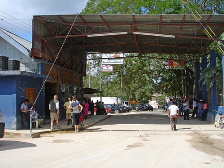
Border crossing from Belize at Melchor de Mencos, Guatemala
Border crossing from Belize at Melchor de Mencos, Guatemala. Photo: Lisa B/flickr

The late twentieth century saw a wave of democratic transitions in Latin America and Eastern Europe. After the fall of the Soviet Union, the former Soviet republics became independent states in their own right, while countries in Latin America began to break away from their colonial pasts, as well as from the dictatorships and civil wars that followed independence in the 19th century. While Huntington’s famous ‘third wave’ of democracy saw the emergence of democratic structures in previously autocratic regimes, unresolved territorial claims, border disputes and questions surrounding the relationship between self-determination and sovereignty continue to affect regional security in Latin America today.

Guatemala and Belize are two countries that have been embroiled in a territorial dispute over land and maritime boundaries since the 19th century. Guatemala  once claimed all of modern-day Belize (which it borders to the Northeast) as its territory, but today restricts its claims to the southern half of the country and its islands.