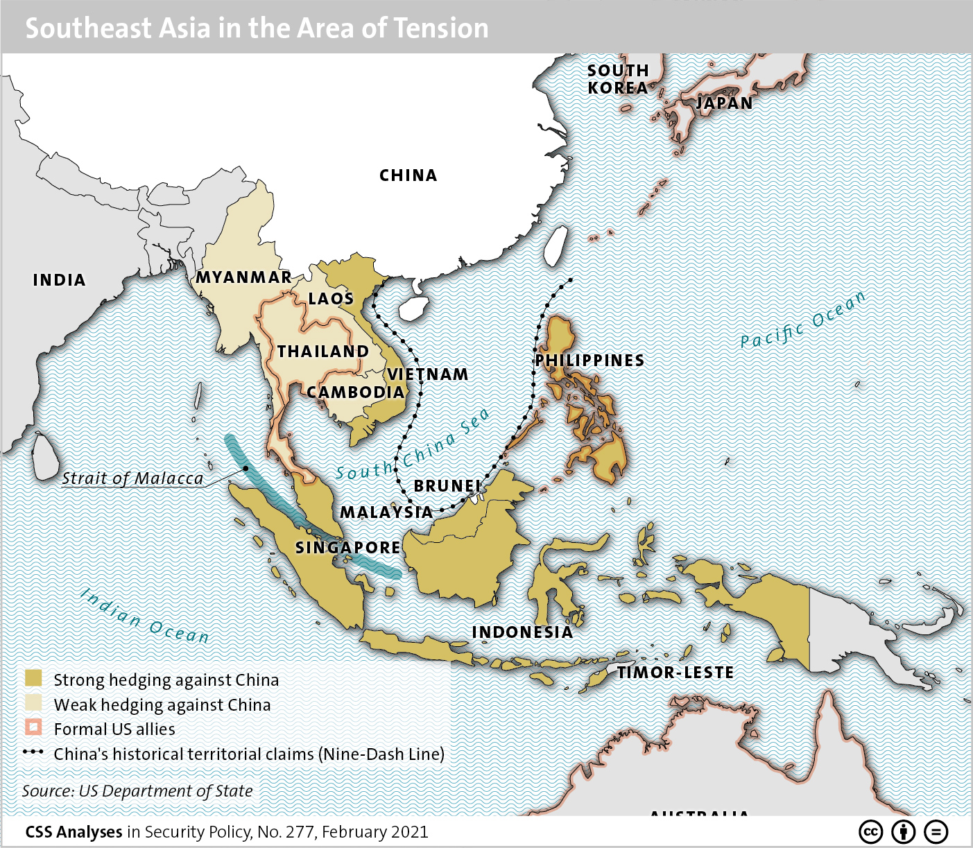
This week’s featured graphic maps Southeast Asia in the area of tension. For more on China-US rivalry in Southeast Asia, read Linda Maduz and Simon Stocker’s CSS Analyses in Security Policy here.
This week’s featured graphic maps Southeast Asia in the area of tension. For more on China-US rivalry in Southeast Asia, read Linda Maduz and Simon Stocker’s CSS Analyses in Security Policy here.
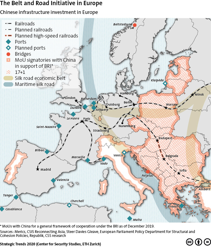
This week’s featured graphic maps the Belt and Road Initiative (BRI) in Europe as of December 2019. To find out more, click here to read this Strategic Trends 2020 chapter by Henrik Larsen and Linda Maduz on how China’s growing influence in Europe has the potential to create new geoeconomic divides.
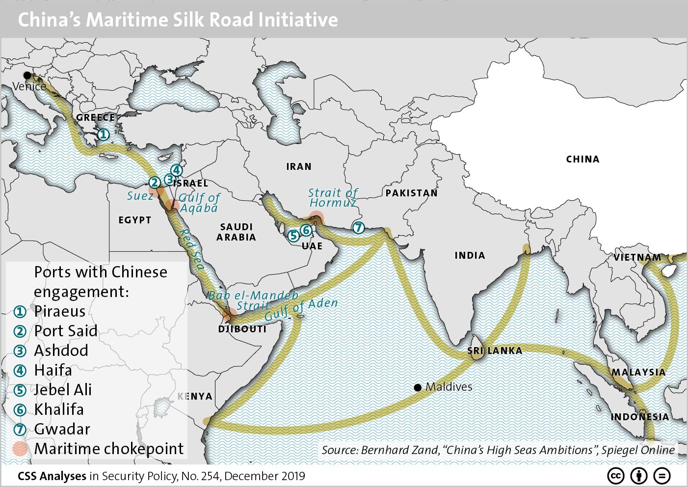
China’s Belt and Road Initiative (BRI) has both a land-based and a maritime component. This graphic provides an overview of the maritime element, the Maritime Silk Road Initiative (MSRI) which connects China to Europe and Africa via the Middle East. For an insight into the BRI in the Middle East, including its implications for China’s impact on the region, read Lisa Watanabe’s CSS Analyses in Security Policy here.
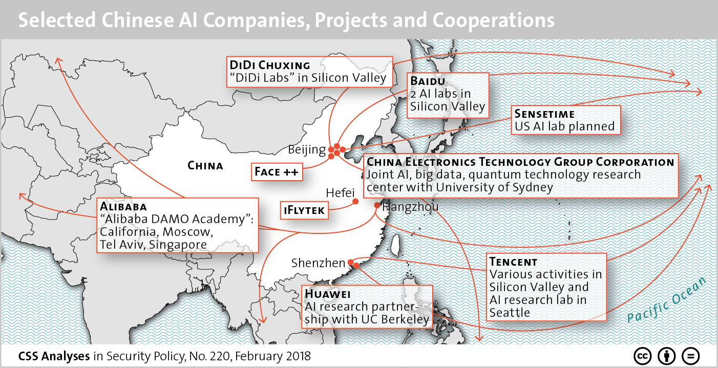
This graphic maps out a selection of Chinese AI companies and provides an overview of their current projects and collaborative efforts. To find out more about China’s ambitions to become a world leader in artificial intelligence, see Sophie-Charlotte Fischer’s CSS Analyses in Security Policy here.
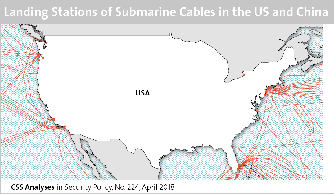
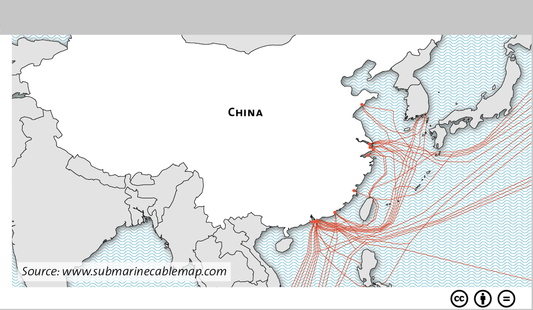 This graphic maps the various landing stations of submarine cables in both the US and China. To find out about cybersecurity in Sino-American relations, see Marie Baezner’s CSS’ Analyses in Security Policy series here.